
Hildegard of Bingen (1098 - 1179) from Causes and Cures
[ add comment ] ( 23 views )
I based my talk at Mediamatic (20 march) on this idea:
The experience of sound is internal, as a process that influences the relationship between the self and the environment. True navigation consists of a continuously coherent relationship between the two.
I read excerpts from books that represent a series of correspondences between my ideas in Sun Run Sun and those of other writers, thinkers composers. They re-enforced five points:
1. static position is derived from movement
Brian Massumi, Parables for the Virtual, Movement Affect, Sensation (Duke University Press 2002)
Chapter 8 is called Strange Horizon and deals with navigation and body topologies (p180)
2. Where am I? Correspondence between place and map, the surroundings and its representation.
Edwin Hutchins Cognition in the Wild (MIT Press 1995)
presents research in cognitive science using navigation on a naval vessel as the primary investigation. Also a large section on Micronesian navigation techniques in contrast to Western techniques.
3. sounds in water, air and solids; the ear in orientation and balance
David Dunn Why do Whales and Children Sing? (Earth Ear 1999) I played the excerpt on underwater sounds. (p33)
4. towards amphibians, swimming, floating, frogs
Umberto Eco The Island of the Day Before (Minerva 1995)
the main character is discovering how to swim from the boat to the shore, and attempts to copy the movements and sounds of a frog... (p361)
5. a planetary, orbiting perspective
R. Buckminster Fuller Intuition (Anchor Press 1973)
this amazing book was written on the eve of the launch of his yacht which he named Intuition. I read a section about moving in and out, rather than up (stairs) and down (stairs), with respect to the earth. (p106-112)
"...we are indeed riding
Within the thin gaseous skin of a planet."
[ add comment ] ( 50 views )
by "mapping" i refer to decisions of how to transform data into sound
this is a relatively simple example:
GPS data is limited in its ranges and frequency of change
the sound is limited by the computing power of the small device
i need identify the prominent characteristics of movement and change in the data and map this to suitable changes in audio. but to do this I need to have an idea of the density of the soundfield I will make, how perceivable changes in data will be, how the characteristics of movement will be traceable in the final sound.
the data has specific numerical ranges and limits. the sound is only limited by human hearing range and distortion of the audio signal. so choices have to be made at the specific level of numerical transformations into audio processes and the final audible result will be particular to those choices.
the sonification of data implies an obligation to choose sounds, and engage in the sonic as composition and as a field of emotive potential to the listener, basically pure sound overlayed or underlayed with patterns of meaning that may or may not be apparent in the audible experience.
[ 1 comment ] ( 39 views )
Amphibian is a futuristic vision / audition into a world on the transitional spaces between water and land, the deltas and coastlines that will shift in constitution over the coming years. Our blind guidance of technologies of navigation systems starts to morph into a techno-intuition of amphibious involvement with environment. Listening to the orbiting satellites we can hear more than our location on a grid, asking us to re-assess and re-negotiate our relation with the environment.
imagine:
satellites,
between land based and in air
to on and under water
now think of coastlines and deltas
and the shifting water line
the altitude trace above and below water-level
the wetness of the sound and the dryness of the sound
now imagine the sound of amphibians
the frogs
towards an amphibious state
of techno-intuition
coastlines are the area of change
if sea-level rises
we are moving underwater
this is dormant in the consciousness
(as is noah's ark)
so the sound will become wetter
(and we will become amphibian)
we run on this line of rising water
blue underwater in air
whale amphibian
sound water
liquid air waves
locating my beach in the sky
cloud surfing
under liquid form unity of substance
float between states
states at edge make a
breaking wave
thunder from location data
[ add comment ] ( 26 views )
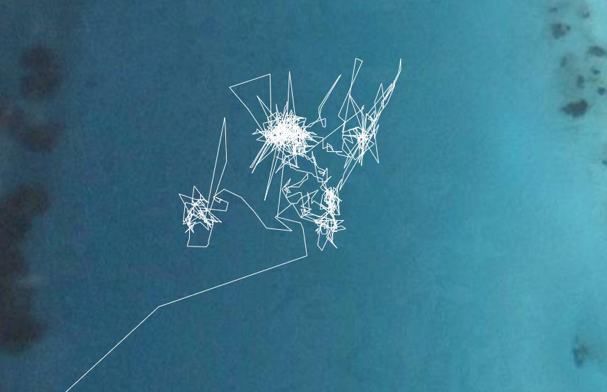
Working on the GPS data (NMEA), receiving, sorting, mapping to sounds and movements in space. With Damian at NIMK. Main issues: GPS parser, to read in the stream of data and make it useful for sound production.
I'm interested in the info of the satellites themselves, the PRN number, elevation, azimuth and signal/noise ratio (often called signal strength). This comes in the GPGSV sentence of the data, there seem to be up to 32 satellites possible but only a maximum of 12 will be seen at any one time. We were getting between 5 and 10 in the artlab on the top floor in NIMK. It's clear to see the changes over time as the satellites move. I imagine each satellite with their own unique sound which is transformed over time by the three parameters (elevation, azimuth, SNR). Damian made a patch that reads all the data but selects the four satellites with best signal, so that when one moves out of range and dissappears it's replaced by another.
The second layer is the location data, or minimum navigation data called GPRMC, which gives longitude, latitude, time, date, speed, track degrees true etc. This is the typical layer used for navigation and is calculated from the satellite positions. It refers to where the player is, not where the satellites are. I want to use this as a different layer of sound in the piece. We talked about ideas of scaling this data for different speeds over the ground, walking, cycling, driving, flying etc - how to keep a sonic identity of a specific place if the data is scaled according to speed. It might be that Brussels ends up sounding like Amsterdam if going fast, but not if walking, which is a nonsense... Is the scaling necessary then? I have to try with the sound, I think it's probably a sonic issue.
Spatialising this sound according the position of the satellites, or the movement of the player. Does this map directly to the real world direction, in which case we need to use a compass, or does this relate to the body of the person? This is different in the portable version and the static installation version.
[ add comment ] ( 23 views )
To breath, to walk, to swim, to rhythm.
The small boat stops becalmed in the middle of the sea, I climb overboard and swim away, then return towards the bow and together we move forwards at the same speed through the water.
The horizon stays at the same distance however far we move towards it. We are sailing forwards but remain in the absolute centre of a disk.
Learning to swim front crawl taught me how to breathe, how to stop salt water flooding down my nose making me choke at every breath.
I breath every two strokes, sometimes every three, whilst my view shifts from the underwater world, cuts through the crumpled surface light and sees the water level and the sky in a second before returning underwater.
Conscious of the responsibility that I am my own engine, as I breathe out through my nose the bubbles rise past my ears with a loud pressure.
The sun is extremely bright around noon so I have to use all three shades on the sextant telescope as I pull down the sun to rest its lower limb on the horizon.
Sleeping on deck ... the sun sets, the moon rises, the moon sets, the planets follow it across the sky, the sun rises ... the sun sets, the moons rises, the planets follow it, the sun rises, the moon sets .... the sun sets, the planets follow it, the moon rises, the sun rises, the moon sets ...
As I walk I remember, and the more I walk the more I remember incidents that I never thought memorable.
[ 1 comment ] ( 36 views )
Thoughts on the shortest day... it's snowing in Amsterdam
I feel like the days have been accelerating and contracting at the same time during the first month of this residency at NIMK. The day of the winter solstice is a good moment for a turn around towards expansion and production.
Until now I've been in a period of investigation, searching through different technical approaches towards building my small GPS-sounding instruments. Most of this was done through experiments, face to face conversations, chance meetings, emailing and internet research. It surprised me that it's so time consuming, but if I didn't do this research I'd be unable to make decisions about the level of technology needed to realize the idea I'm after. This is the 'material' I'm working with after all. It's a balance between research, finding the critical amount of knowledge needed, and keeping open to changes on the ideas level - which results in a state of perpetual tension...
This artistic process has been like the sonic process of filtering and compression, now i want to start building from these fragments into something new.
[ add comment ] ( 22 views )
I am working towards an ideal of intuitive navigation, where a relation to environment (climate, terrain, landscape) is absorbed into an embodied awareness of location and movement, where advances in technological infrastructures for location navigation and weather prediction also become absorbed into our consciousness. At the moment these new technologies are leading us away from this ideal, because they are seen as functional time saving, economic, problem solving. These attitudes are constraining the development towards an expanded and expansive relation to environment. Through my work as composer and media artist I see the potential for sound to act as a catalyst towards a hybrid intuition of navigation. The refusal of sound to be held down by functional constraints makes it a fitting vehicle to explore this potential hybrid form of knowing and experiencing.
[ add comment ] ( 24 views )
Yolande Harris
artist in residence at Montevideo/ Netherlands Media Art Institute, Amsterdam
19/11/2007 - 19/02/2008
Navigations and locations, navigating through locations, locating my navigations, can you navigate?
I am witnessing a sensation of dislocation from my immediate environment by it's alternative representation in the data of position, the figures of longitude and latitude updated every second as I move. What place is there for my sensations, my phenomenology, my conscious and unconscious awareness of space if this knowledge is so efficiently and functionally made redundant by the technologies of satellite navigations?
Looking into historical techniques of navigation this split between environment and location, or location and position is already apparent, although a bridge was present in the direct observation of environment or sun whose data was then used in calculations. The technique called "sun run sun" to chart ones trace across an ocean requires taking three sextant sights on the sun, before during and after its highest point in the day. The data of the suns altitude at a specific time, the speed and direction of the boat through the water, the assumed (estimated) position, and the calculated adjustments from tabulated data, combine to give a location at noon to a variable accuracy.
In my mind, this time consuming technique that is so open to mistakes and so imprecise in its scale of accuracy, in short so much of another age in its priorities, is a perfect starting point to dream of the potential shifts occurring through new navigation techniques. Satellite navigation is being developed in a way that closes down the openness of direct observation and the possibility of mistakes, and the input of choice, intuition and improvisation. At the same time this satellite navigation does not need to be reduced to the mundane but could open us up to a possible consciousness of environment, a hybrid of locative intuition through technology..
This project will be an experiment in drifting, combining the accuracy of the grid with the intuition of movement. Electronic sound is the primary vehicle for exploring these open data worlds because its inherent abstraction refuses to be held down by the functional. Although it is made out of the information it receives from the satellites, this sonification allows us to observe the potentials of our floating extended locations. What is it to navigate? What is it to know I am here now?
[ add comment ] ( 19 views ) | related link
 Archives


